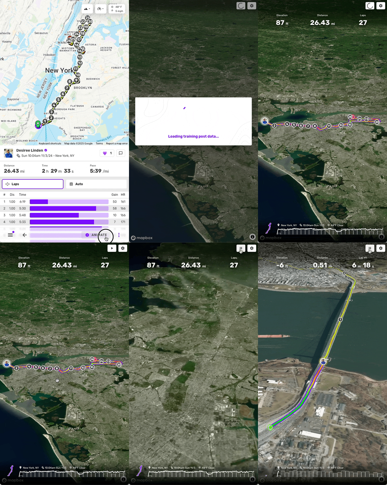
After posting some GPS training to Trackster, you can see an in-depth 3D view of your data
1. Go to the training post on your Trackster feed
2. Click the GPS map
3. Click the Animate button
4. Click the 3D map button
1. Go to the training post on your Trackster feed
2. Click the GPS map
3. Click the Animate button
4. Click the 3D map button

Additional options
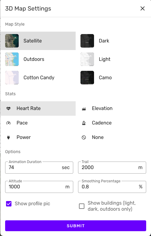
You can customize the 3D maps view:- Select the map style (Satellite, Dark, Light, Outdoors, Cotton Candy, or Camo)
- Stats & path (This will be the displayed gradient on the path)
- Animation duration
- Trail (distance the camera will be behind the circle marker)
- Altitude (distance the camera will be above the circle marker)
- Smoothing percentage


